
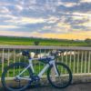
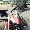


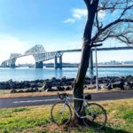
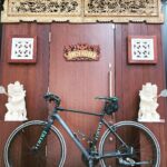
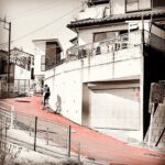
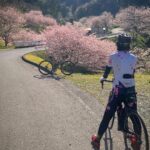
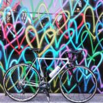
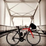
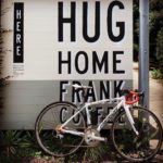
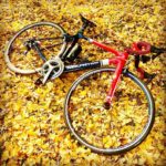
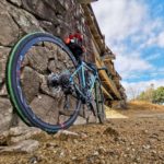
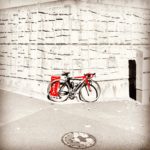
女子が集まって ツナちゃんアテンドでGO‼️ 河内貯水池→しん門さんでランチ→若戸渡船 →とらやの回転焼き→ツナちゃんのバイト .. #ロードバイクJP</span>")

は宮崎県南部に位置し、無人島の島(OvO) 【周囲】約3.5km~4.0km 【面積】約32~35ヘクタール 目的は、約100匹のニホンザルが生息しているらしく見てみたくてこの地に来たが…ここに行くにはすぐ目の前にみえてま .. #ロードバイクJP</span>")

/›› もはや汗なのか、雨なのかわからない…☺︎ #ロードバイクJP</span>")


ノ。 … . .. #ロードバイクJP</span>")


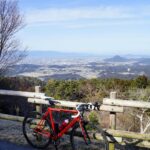
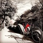
/ #阿蘇くじゅう国立公園 #阿蘇くじゅう国立公園ゆふいん狭霧台 すすきが夕日に照らされ黄金色に♪ #ロードバイク #ロードバイク女子 #ロー .. #ロードバイクJP</span>")


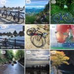
出典:instagram
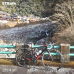
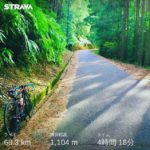
Route 15/414 – 30 KM / +580m Climbing (ENG/日本語) – Matsuzaki-Kawazu/Shizuoka Prefecture – Max. (~9%) / Elevation 310m
ルート15/414 – 30 KM / + 580m登山-松崎-河津/静岡県-最大(〜9%)/標高310m
Route 15/414 (blue line on road map) is the major east-west connecting road in South Izu. There are 2 Cat.3 climbs at East and West ends (see road map with the mountain stickers and pictures 2&3) with gentle rolling hills along the route. Although the gradients are not steep and the rolling hills are pleasant to ride, I often underestimate this route when visiting climbs in Western Izu. There is a flat shortcut to Shimoda (6.7km) by taking R414 at the intersection of R414 and R15 (red line on road map). There is a fun winding descent from Basara Pass to Matsuzaki (picture 5). The Mine Hill Alternate climb (picture 6 – orange line on road map – 2.2km/9.8%) is a shortcut to the eastern tunnel on the route.
国道15/414号線は (地図の青い線)、南伊豆の主要な東西接続道路です。東端と西端に2つのCat.3登山があり(山のステッカーが付いたロードマップを参照ー写真2&3番). ルートに沿ってなだらかな丘があります。勾配は急ではなく、なだらかな丘は乗り心地が良いですが、伊豆西部の登りを訪れるとき、私はしばしばこのルートを過小評価します。R414とR15(地図の赤い線)の交差点でR414を利用すると、下田(6.7km)へのフラットなショートカットがあります。バサラ峠から松崎への楽しい曲がりくねった下り坂があります (写真4番)。ミネヒルオルタネートクライム(地図上のオレンジの線-写真6番ー2.2km / 9.8%)は、ルートの東側トンネルへの近道です。
#japancycling
#japancyclingtours
#izucycling
#izucyclingclimbs
#roadbike_jp
#ロードバイク乗り
#rapha_rcc
#rapha_japan
#伊豆観光
#specialized_japan
#s_worksofficial
#fuji_hakone_izu_national_park
#izugeopark
#japancyclingroad

♡を押してね!ランキングに反映されるよ♪
| 0 |
コメント🔽 |
ブログ掲載方法は下記Instagramをチェック!
 ロードバイク.jp
[PickUP!おすすめ記事]

[Amazon検索]
今週♡を集めた記事は?(20件)
-
 【 #NHK平野原FM放送所 】 ( #サンデー午前中ライド ① ) 今日は『 TETSUさんラ… +1
 -
 【 #手賀沼の河津桜 】 ( 🌸お花見だよ!🍡手賀沼ライド③ ) #手賀沼 の #河津桜🌸 はま… +1
 -
 Black Sheep Cyclingのビブは後ろから撮ってもらった時にロゴがしっかり見えるところが… +1
 -
 若洲海浜公園まで、新春初ライド。 かすみがうらマラソンに向けて、そろそろRunも再開します。 … +1
 -
 【 #白石峠タイムアタック 】 ( バレンタインだよ!白石峠ぽたりんぐ?? ③ ) 白石アタ… +1
 -
 . ずーーっと気になっていた #CSPD のジャージ☺️‼️ . このジャージはシンプル… +1
 -
 #のんびり走ろう淡路島 今日は暖かい☀️ライド日和 五色のHashizume WAVE115 記念に… +1
 -
 【 #物見山公園 】 ( バレンタインだよ!白石峠ぽたりんぐ?? ① ) バレンタインと無… +1
 -
 都内某所 #ビアンキ #Bianchi #クロスバイク #ローマ4 #サイクリング #ポタリング #… +1
 -
 ご本人様 @plus.ultra_cff 【 #高木屋老舗 】 ( #サンデー🍡団子ソロライド … +1
 -
 【 #堂平山頂 】 ( バレンタインだよ!白石峠ぽたりんぐ?? ④ ) ヘロヘロでも #堂… +1
 -
 . 早咲桜の大知波桜が咲き始めてます🌸 う〜ん、いい色🥰 昼は暖かかったしちょっとずつ春が来ている、… +1
 -
 【 #葛西臨海公園の桜 】 ( 🌸お花見🍡だよ!ゆるゆるぽたりんぐ ③ ) #葛西臨海公園 の… +1
 -
 【 #手賀沼の河津桜 】 春の訪れ、あちこちから #河津桜満開 のニュースが。 #手賀沼 の #河… +1
 -
 裏古賀志初挑戦。 明日の赤城山一周に向けて体の準備。適当なコースが思い浮かばなかったので、裏古賀志に… +1
 -
 【 #さくら堤公園 】 ( 🌸お花見🍡だよ!ゆるゆるぽたりんぐ ② ) #花より団子🍡 先ず… +1
 -
 【 #柏公園南の激坂 】 ( 🌸お花見だよ!🍡手賀沼ライド② ) 『 この先急勾配 通行注意 柏… +1
 -
 【 #小林もみじ園 】 ( かわぐち🍁紅葉巡りライド⑤ 】 やっぱり最後はここでしょ!👍。… +1
 -
 【 #八重洲コーヒー店 】 ( 🌸お花見🍡だよ!ゆるゆるぽたりんぐ ④ ) #YAESUcof… +1
 -
 【 #島田橋 】 ( バレンタインだよ!白石峠ぽたりんぐ?? ⑥ ) #おっぺがわ に架… +1
リアルタイム24時間ランキングを見る🔽
今月♡を集めた記事は?(20件)
- #のんびり走ろう淡路島 今日は暖かい☀️ライド日和 五色のHashizume W… +3
-
 【 #CafeGardenHASEGAWA 】 ( 🌸お花見だよ!🍡手賀沼ライ… +1
 - 【 #NHK平野原FM放送所 】 ( #サンデー午前中ライド ① ) 今日は… +1
-
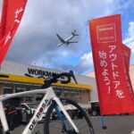 ご本人様 @moco_moco_tomoko ✈︎✈︎✈︎ ワークマンのサイクル… +1
 -
 . 今朝は #新城のマチュピチュ ヒルクライム🚵🚵🏻♀️ #新城市市川の桜 は… +1
 - 【 #手賀沼の河津桜 】 ( 🌸お花見だよ!🍡手賀沼ライド③ ) #手賀沼 … +1
- Black Sheep Cyclingのビブは後ろから撮ってもらった時にロゴがし… +1
-
 2021.2.27 滋賀県栗東市を巡るライドに出掛けました。 あまり観光地化され… +1
 -
 ワクチン💉3回目の副反応で自転車乗れない日は過去picから 『 Supreme … +1
 - 【 #白石峠タイムアタック 】 ( バレンタインだよ!白石峠ぽたりんぐ?… +1
-
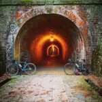 【明治トンネル】 明治9年開通🛣 趣のある文化遺産 詳しくは👇 https://… +1
 - . ずーーっと気になっていた #CSPD のジャージ☺️‼️ . このジ… +1
- 若洲海浜公園まで、新春初ライド。 かすみがうらマラソンに向けて、そろそろR… +1
-
 #lovewall #パナソニック汐留美術館 ❤️💛💙💚💜💗 #ラブウォール #… +1
 - 【 #物見山公園 】 ( バレンタインだよ!白石峠ぽたりんぐ?? ① )… +1
-
 2020年12月 サイト内♡獲得TOP3! 最も人気の投稿を月1発表 +1
 -
 . 🌸 #ひめクル ライド🌸 . . 今回のひめクルライドは #しまなみ海道… +1
 - ご本人様 @plus.ultra_cff 【 #高木屋老舗 】 ( #サンデー… +1
-
 . . セントラルホテル伊万里の支配人です🍃 セントラルホテル伊万里では、 ご宿… +1
 - 【 #堂平山頂 】 ( バレンタインだよ!白石峠ぽたりんぐ?? ④ ) … +1
リアルタイム24時間ランキングを見る🔽
最も♡を獲得した投稿は?
-
 【 #彩湖にさあいこう 】 ( #耳をすませば聖地巡礼 ライド🚴♂️🚴♀️🚴♂️💨💨① )… +28
 -
 【 #かわぐち光のファンタジー2020 】 ( 川口西公園、東口ペデストリアンデッキ、東口… +6
 -
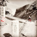 【 #九重神社 】 ( かわぐち🍁紅葉巡りライド③ ) #御朱印マニア ならみんな欲しがる #… +5
 -
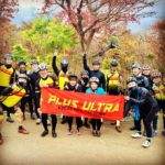
 @plus.ultra_cffさんの投稿 #ロードバイクJP #ロードバイク好きと繋がりたい #自転… +5
 -
 流行りに乗ってベストナインをやってみました🥰 今年は本当に色んな事がありましたね。 私は、9月に… +4
 -
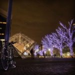
 前回の横浜ナイトライド ちょっとLightroomで編集したけど 元々の写真もいいんだよな😆 最近ど… +4
 -
 【 #東四つ木避難橋 】 ( 2021年初め荒サイライド② ) #荒川サイクリングロード から… +4
 -
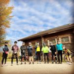
 今日は近隣チームの皆さんと合同ライドでした😆✨ 今回は、滝の拝、一枚岩、虫喰岩、潮岬という 古座… +4
 -
 乗り遅れた感満載ですが・・・💧 あけましておめでとうございます🎍⛩ 今日が初乗りでした… +4
 -
 #クロスバイク #サイクリング #自転車のある風景 #自転車日和 #自転車のある生活 #チャリ … +4
 -
 @plus.ultra_cffさんの投稿 #ロードバイク好きと繋がりたい #ロードバイク仲間欲しい … +4
 -
 【 #赤山城跡 】 ( かわぐち🍁紅葉巡りライド② ) #城跡 にも寄りました。 復元された大き… +4
 -
 Wilier×白良浜(和歌山県) 今日も一日がんばりしよう‼️😆 #wakayama800モバ… +4
 -
 メリークリスマス🎉🎄🎅 昨日は思いつきのクイズに回答してくださって ありがとうございました… +4
 -
 【 #北区立中央公園 】 ( #北区ポタリング部 🍁北区紅葉ライド④ ) こういうの撮りたかっ… +4
 -
 【 #西福寺 】 ( かわぐち🍁紅葉巡りライド① ) 今回の #サンデー午前中ライド は、 … +4
 -
 【 #荒川サイクリングロード 】 ( ベニと走ろう!東京ライド🚴♂️🚴♀️🚴♂️💨💨⑦… +4
 -
 【 #新中川水管橋 】 ( 越谷ぐるぐるカフェぽたりんぐ③ ) #中川 を挟んだ対岸の吉川… +3
 -
 【 #北区の清水坂 】 ( #サンデー午前中ライド 北区激坂巡り① ) 赤羽駅西口から環七へ向か… +3
 -
 高野山の紅葉観光ポタリング③ 真っ赤なもみじとアリアの写真を集めて見ました。 #もみじ #高野山 #… +3
 -
 加西市 王子皿池親水公園 2020/11/23 水が少ないので✨ 橋の下に降りれました♪ 橋✨下… +3
 -
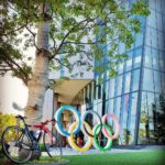 【 #日本オリンピックミュージアム 】 ( #東京おのぼりさん ライド ) しかし昨日もめっ… +3
 -
 追い込んで登った日の写真。(和歌山県 那智勝浦町) 阿弥陀寺からの景色は、いつも水平線のラインが… +3
 -
 【 #金のなまず 】 ( 越谷ぐるぐるカフェぽたりんぐ番外編 ) 金のなまずの親子と記念… +3
 -
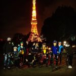 【 #東京タワー 】 (北区ポタリング部イルミネーションライド② ) みんなでわちゃわちゃと… +3
 -
 【 #石神井坂 】 あの飯能の #激坂 ラスボス #ネノゴン を彷彿とさせる #ヘアピンカーブ… +3
 -
 【 #モンチッチ公園 】 ( 2021年初め荒サイライド③ ) われら昭和世代の愛すべきキャラクタ… +3
 -
 コロナで閉鎖?と思ったら 「強風のため参拝停止」と😨 那智山に登り始めて8年目になりますが 閉鎖… +3
 -
 【 #のらくろマンホール 】 #のらくろ GETだぜ!!😆。 ・ #neilprydenazá… +3
 -
 【 #大井弁天の森 】 ( #南西部自転車さんぽ ⑤ 】 ふじみ野のポケモンスポット!😂 週… +3
リアルタイム24時間ランキングを見る🔽
▶カテゴリー別 記事一覧こちら
[おすすめ記事]
初心者必見!ロードバイクはネット通販で楽々購入できます
|
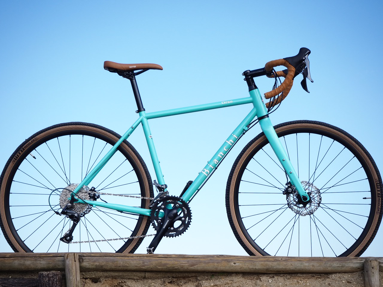
Bianchiに乗りたいアナタにおすすめ低価格モデル2020年 | ||

|
ロードバイク関連の人気おすすめアイテムまとめ | ||
|
[PR]
|
|||

[YOUTUBE]
ショートムービーにロードバイクの魅力を詰め込みます!
注目のサイクル用品レビュー動画も!
開始したばかりですが!ゆっくり更新していきます!

【コロナ対策にお得なお知らせ】
『ロードバイク.JP』と、今話題の無料テイクアウトアプリ『menu』がコラボ開催中!
![初回購入[menu]【iOS】](data:image/gif;base64,R0lGODlhAQABAIAAAAAAAP///yH5BAEAAAAALAAAAAABAAEAAAIBRAA7)
無料アプリのダウンロードだけで¥1,500分のクーポンをプレゼント!
いつも『ロードバイク.JP』をご覧いただいている方へ優待特典です!
期間限定の特別クーポンコードはコチラ⇛【36801】
iPhone版はコチラから⇓
Andoroid版はコチラから⇓
🔗カテゴリー別 記事一覧こちら

[公式LINEアカウント]
定期的にお得情報やおすすめのサイクル用品を紹介します😊のんびりお届けしますのでお気軽に友達登録してください🚩